Urban Planning
Planning, GIS, and Urban Data Analytics Projects from the M.S. Urban Planning Program at the Columbia University Graduate School of Architecture, Planning and Preservation
Studio Project
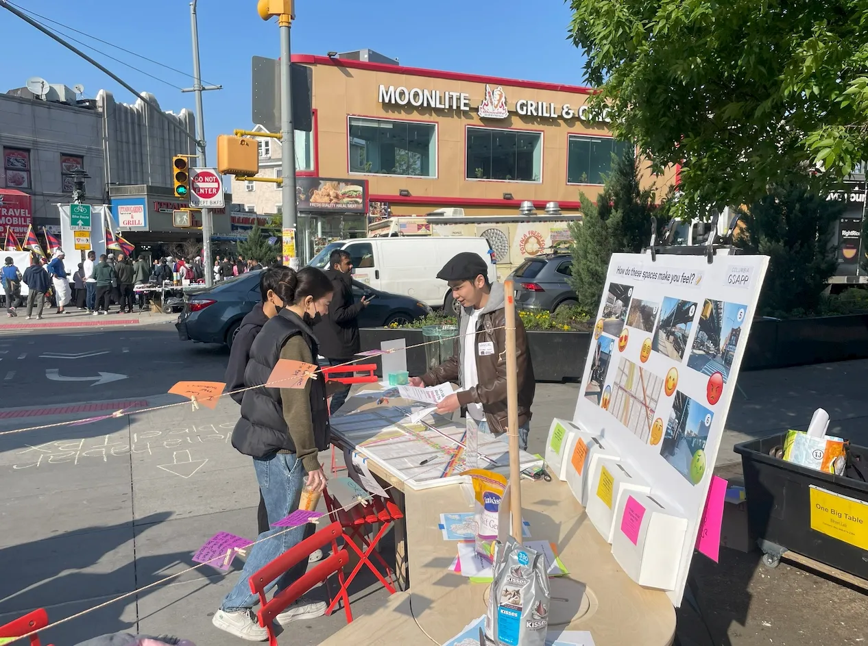
Humanizing the Interborough Express (IBX)
This studio was tasked with facilitating a conversation between the Metropolitan Transportation Authority (MTA) and New York City's Department of City Planning (Queens and Brooklyn Offices) to navigate the decision-making processes of transportation planning concerning the proposed Interborough Express (IBX).
Read moreRecent Projects
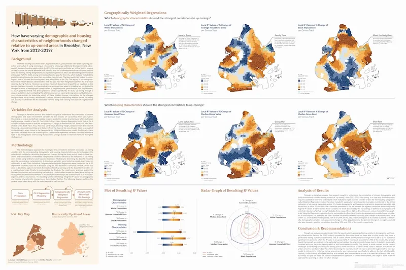
Up-Zoned Out: Geographically Weighted Regression Analyses of Up-Zonings in Brooklyn (2013-2019)
How have varying demographic and housing characteristics of neighborhoods changed relative to Up-Zoned areas in Brooklyn, New York from 2013-2019?
Read more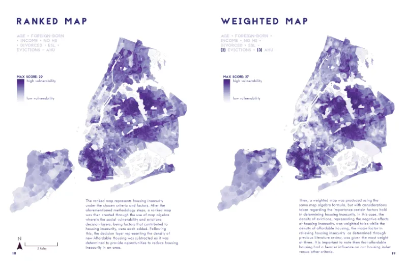
Mapping Housing Insecurity in New York City (2019)
What are the demographic and land use characteristics and areas of high and low housing insecurity in NYC?
Read more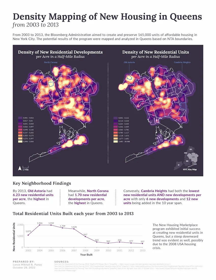
Density Mapping of New Housing in Queens
Where was new residential development concentrated in Queens from 2003 to 2013?
Read more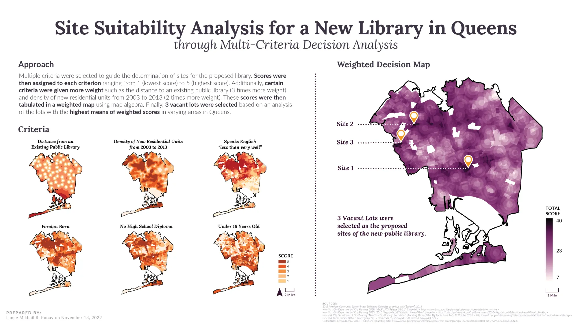
Site Suitability Analysis for a New Library in Queens
Considering the new development in Queens, the current distribution of libraries, and the populations targeted by library programming, where might a new library be sited in the borough?
Read more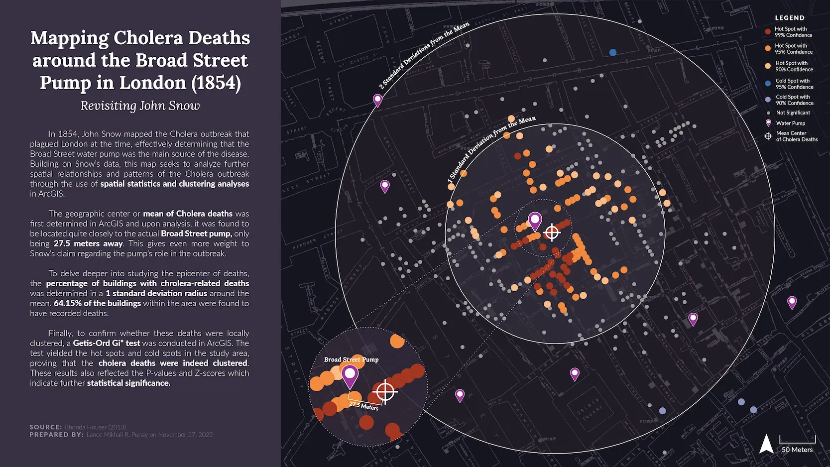
Mapping Cholera Deaths around the Broad Street Pump (1854)
Were cholera-related deaths statistically “clustered” around the Broad Street water pump or were they spread across the neighborhood (either evenly or randomly)?
Read more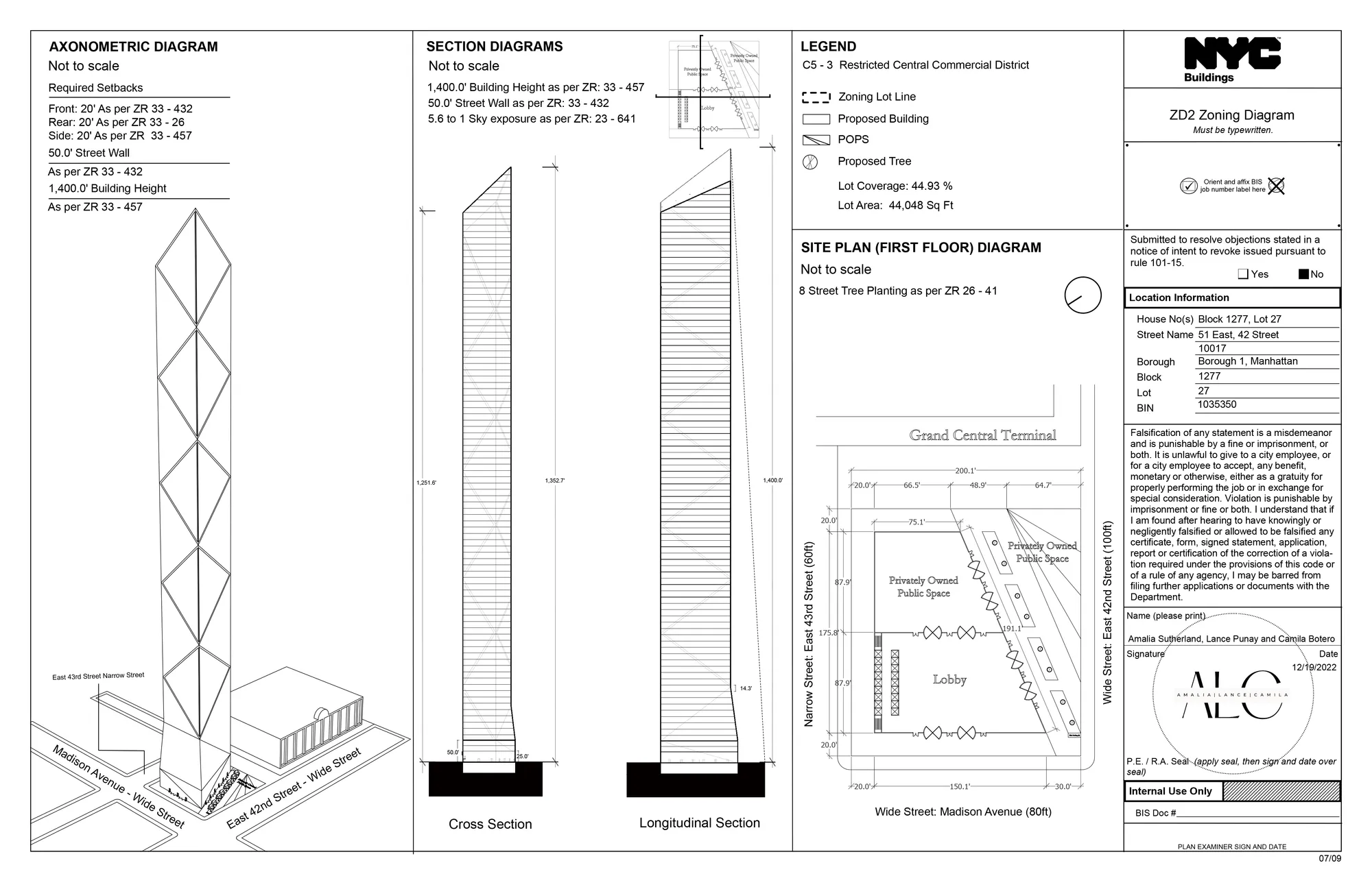
One Vanderbilt Zoning Analysis
This project entailed proposing a supertall tower and conducting a zoning analysis for a 44,048 square feet lot located adjacent to Grand Central Terminal in Manhattan, New York
Read more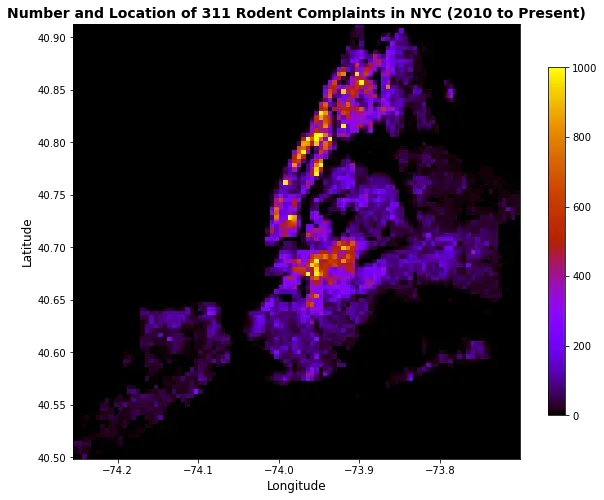
Rats and the City
Walking home after my first night class at Columbia University, I found myself on the lookout for anything suspicious as I had recently just moved to New York City. Curiously, as I was about to enter my apartment building, I caught a glimpse of a rat on the sidewalk curb staring right at me.
Read more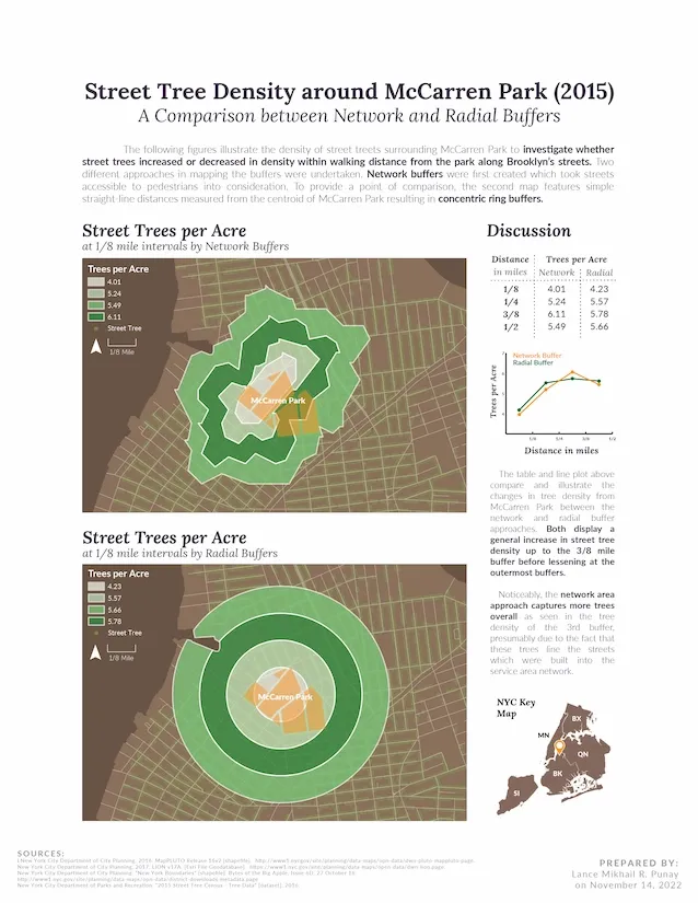
Street Tree Density around McCarren Park (2015)
Do street trees increase or decrease in density with walking distance from McCarren Park, along Brooklyn’s streets?
Read more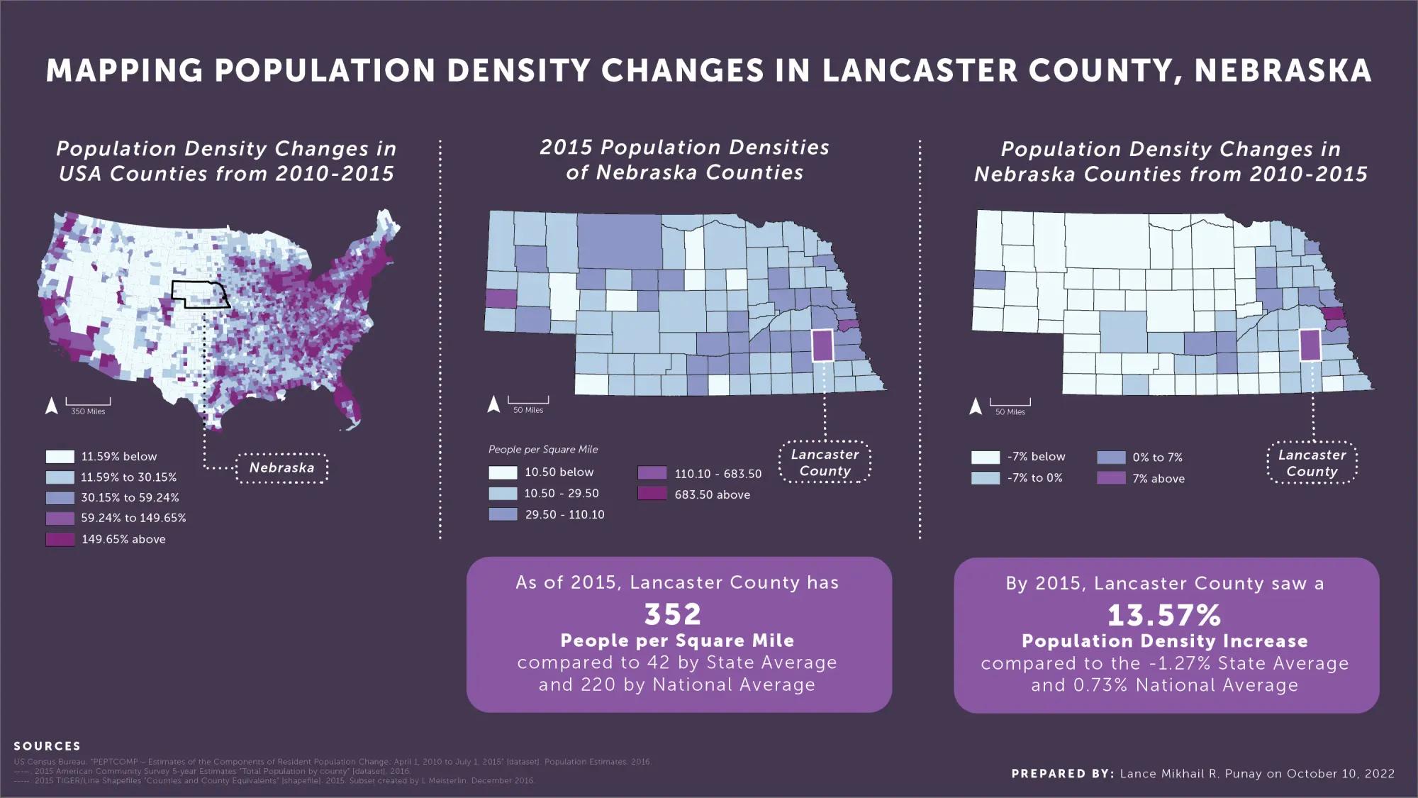
Mapping Population Density Changes in Lancaster County, Nebraska
What were the trends in population change and population density change in Lancaster County, Nebraska, from 2010 through 2015?
Read more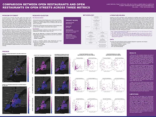
Comparison between Open Restaurants and Open Restaurants on Open Streets across 3 Metrics
What are the impacts of Open Restaurants on Vehicular Crash Rates, relevant 311 Complaints, and Rodent Complaints in New York City comparing the period of March 2019 to February 2020 and July 2021 to June 2022?
Read more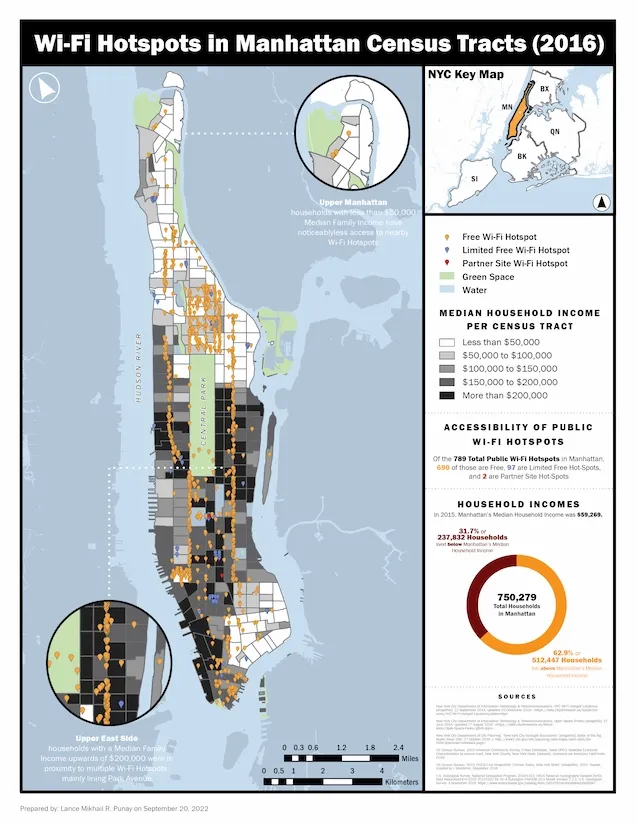
Wi-Fi Hotspots in Manhattan Census Tracts (2016)
Are lower-income neighborhoods in Manhattan comparably served by public Wi-Fi hotspots as higher-income neighborhoods?
Read more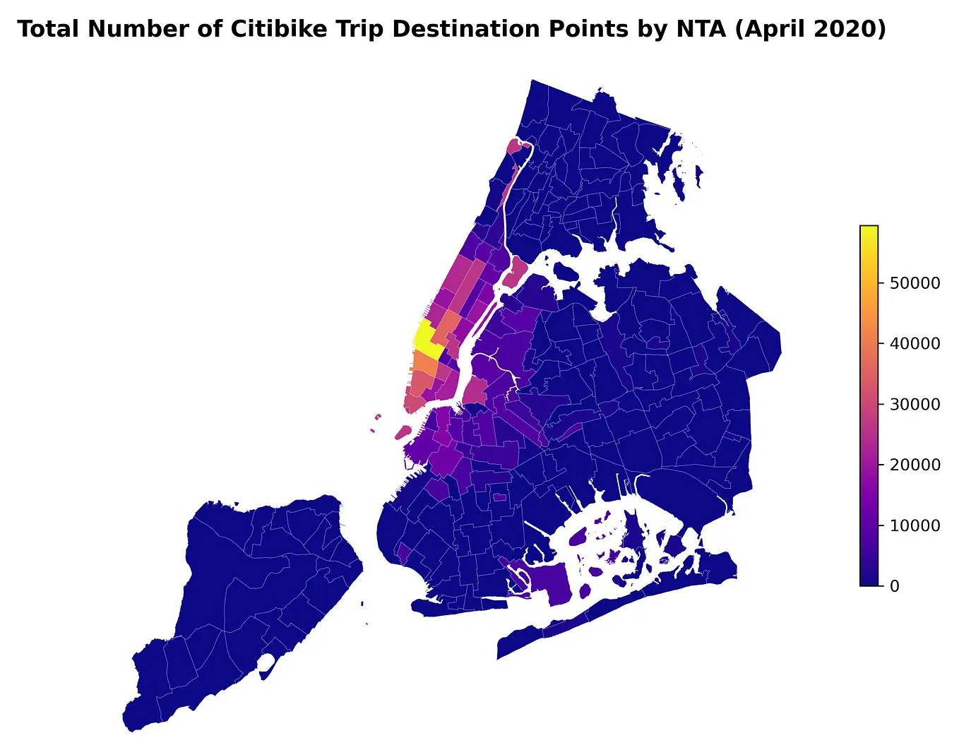
Citi Biking through the Pandemic
Launched in 2013, the Citi Bike program serves as New York City’s premier bike share system and currently stands as the largest one in the USA. From an initial set of 6,000 bikes in 2013, Citi Bike has become a staple in NYC’s transportation system, even recording an all-time high single-day ridership of 138,372 rides on September 9, 2022.
Read more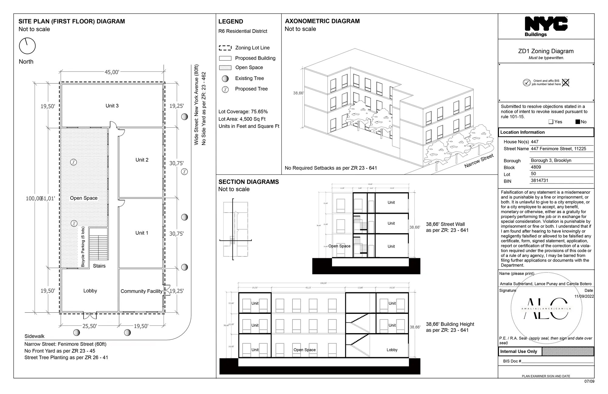
448 Fenimore Street Zoning Analysis
This project involved the design proposal and zoning analysis for a residential development on a 4500 square feet lot located at 448 Fenimore Street in Brooklyn.
Read more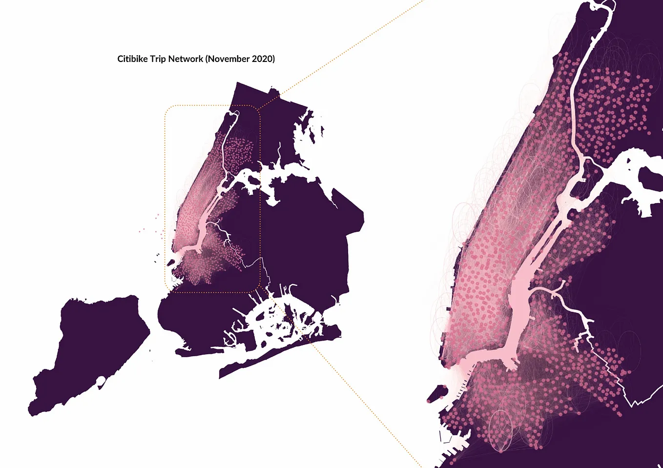
Where to? Citi Bike Trends in New York City
November 2020 proved to be a pivotal month in the United States of America when the country not only held a historic presidential election, but also did so in the middle of the COVID-19 pandemic.
Read more